
Deep in the hills of Khonmoh, barely a few kilometres beyond Srinagar’s urban sprawl, the landscape seems unremarkable at first glance. There are slopes, exposed rocks and the familiar contours of Kashmir’s mountains.
But hidden in those rocks is something far older than Kashmir itself.
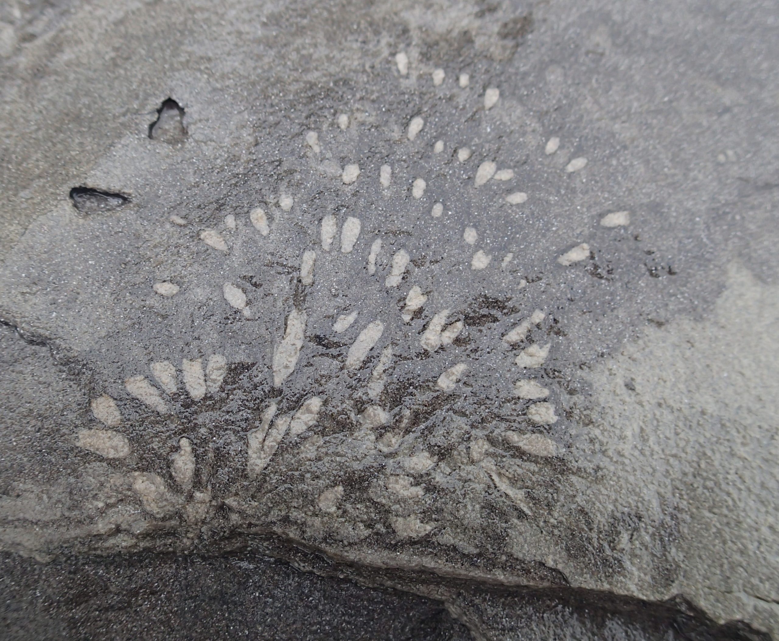
At Guryul Ravine lies a geological archive stretching back about 252 million years – to a moment when life on Earth suffered its most devastating known mass extinction. The rocks preserve a remarkably continuous record of the transition from the Permian to the Triassic periods, a geological turning point that transformed the planet and reshaped the course of life.
In 2025, the Geological Survey of India (GSI) formally recognised Guryul Ravine as a National Geoheritage Site.
The designation should have marked the beginning of a new chapter for the site. Instead, nearly a year later, one crucial piece remains unfinished: the formal notification by the Government of Jammu and Kashmir and the effective protection and management measures that would follow it.
The issue has returned to focus after the GSI, responding in writing to a grievance seeking scientific assessment, conservation and exploration of the wider Guryul-Khunmoh-Mandekpal fossil landscape, made clear that the ball is now partly in the J&K Government’s court.
“Considering the immense geological and palaeontological significance of the Guryul Ravine,” the GSI said, it declared the site a Geoheritage Site of National importance through a resolution dated October 16, 2025.
Two months later, on December 17, it wrote to the J&K Government requesting notification and steps towards conservation.
Then, on March 12, 2026, GSI officials and the district administration carried out a joint inspection of the area to examine conservation and development possibilities.
The scientific machinery, meanwhile, has continued to move.
The GSI has taken up a research and development project covering Guryul Ravine and Mandakpal National Geoheritage Sites, aimed at documenting and deepening understanding of their geological and fossil significance. It has also initiated efforts to install marker pillars at the Global Permo-Triassic Boundary and other fossil-bearing locations.
Yet the central question remains: when will recognition become protection?
The importance of Guryul begins with the rocks themselves.
Located in the Khonmoh area, roughly 14 to 20 km from Srinagar, the ravine exposes a sequence of rocks formed in an ancient marine environment. They belong to a period when the Earth was undergoing profound environmental upheaval.
Around 252 million years ago, at the end of the Permian Period, the planet experienced the end-Permian mass extinction – an event so severe that it is widely regarded as the greatest mass extinction in Earth’s history.
Around 90 percent of marine species and about 70 percent of terrestrial vertebrate species are estimated to have disappeared.
The causes and precise sequence of events surrounding the catastrophe remain subjects of scientific investigation. But Guryul provides researchers with something invaluable: rocks that preserve a detailed record of the environmental transition associated with this extraordinary episode.
The exposed section is more than 100 metres thick and is described in research as apparently continuous across the Permian-Triassic transition.
For geologists, continuity matters.
A geological boundary is not merely a line on a map. Scientists need physical sections of rock that preserve the sequence of changes through time so they can compare fossils, sediments, chemical signatures and other evidence. Guryul has therefore occupied an important place in scientific efforts to understand and define the Permian-Triassic boundary.
At one point, the site was even considered as a candidate for a Global Stratotype Section and Point – essentially an internationally recognised reference section used to define a geological boundary.
That distinction alone places the ravine in a very different category from an ordinary landscape.
Its value is not simply scenic. It is archival.
The rocks are a record of a vanished world.
Guryul has also attracted international scientific attention for sedimentary structures associated with the period of environmental upheaval.
Some researchers have interpreted unusual deposits and seismites at the site as evidence of ancient tsunami activity. Such interpretations have contributed to the site’s reputation as a possible record of dramatic events that accompanied the end-Permian crisis.
But science demands caution.
Claims that Guryul preserves evidence of the “world’s first-ever recorded tsunami” should not be presented as settled fact. While some researchers have interpreted particular structures as tsunami deposits, other interpretations suggest that powerful storms could have produced some of the observed features.
That debate, rather than diminishing Guryul’s importance, underlines why the site deserves careful scientific study.
The value of a geological site lies not only in the answers it provides, but also in the questions its rocks continue to raise.
Guryul’s significance is hardly a recent discovery.
Geological investigations in Kashmir began more than a century ago, with British geologists documenting the region’s geology during the 19th century.
Henry Haversham Godwin-Austen published geological work on Kashmir in the 1860s. Later, researchers including Hayden and Middlemiss added to the understanding of the region’s geological formations. Indian and Japanese geological teams subsequently contributed to studies of Kashmir’s Permian-Triassic rocks.
Sir Walter Lawrence’s The Valley of Kashmir, published in 1895, also recorded geological and fossil observations relating to the region.
Across generations, scientists have returned to the rocks of Kashmir to investigate fossils, sedimentary formations, geochemistry, palaeoclimate and the environmental changes surrounding the great extinction.
Guryul has consequently become more than a local geological curiosity. It is part of a much larger scientific story about how the planet changed – and how life responded.
The GSI’s national recognition has now created an opportunity to give that scientific legacy a stronger institutional framework.
The agency has indicated that Guryul’s location within the Dachigam National Park and Eco-Sensitive Zone strengthens the possibility of statutory protection.
The GSI said the possibility of providing urgent protection under the Dachigam National Park and Eco-Sensitive Zone framework had been discussed with the J&K Government.
But the agency has also explicitly described the J&K Government notification as “awaited”.
That gap between recognition and implementation is where concerns are growing.
The Environmental Policy Group (EPG), which has been campaigning for Guryul’s protection, has renewed its appeal to the J&K Government, seeking the intervention of the Chief Secretary.
EPG Convenor Faiz Bakshi has argued that national geoheritage status must now translate into concrete protection, strict compliance and a comprehensive development plan.
The concerns are practical as much as scientific.
Dumping and other activities around the site have raised fears that the very geological exposures that make Guryul internationally important could be damaged before adequate safeguards are put in place.
For a fossil-bearing geological section, damage can be irreversible.
A building can sometimes be repaired. A road can be redesigned. A forest can regenerate over time.
But once a critical rock exposure is destroyed, buried or altered, the information contained within it may be lost permanently.
There is, however, another way of looking at Guryul: not simply as a site requiring protection, but as an opportunity waiting to be developed intelligently.
The GSI has suggested that scientific work, combined with the eventual J&K Government notification, could provide a foundation for sustainable geotourism and geoconservation.
It has also indicated that these measures could help lay the groundwork for a future Geopark proposal, subject to UNESCO’s prescribed criteria and procedures.
That possibility could give Kashmir a distinctive new kind of tourism asset.
Guryul is unlikely to compete with Kashmir’s lakes, gardens and mountains as a conventional tourist attraction. Its appeal is different.
Its audience could include geologists, palaeontologists, university researchers, students, educators and visitors fascinated by the deep history of the planet.
It could become an outdoor classroom where visitors do not merely look at rocks but learn how scientists reconstruct ancient environments from them.
With appropriate interpretation, marked geological sections, research facilities, educational material and strict conservation protocols, the site could potentially combine science, education and responsible tourism.
But development would have to follow conservation – not the other way around.
That distinction is crucial.
The temptation with a site of growing tourism potential is to build first and protect later. At Guryul, such an approach could undermine the very resource that gives the place its value.
The irony surrounding Guryul is difficult to miss.
The rocks have survived for roughly 252 million years, preserving evidence from one of the most violent chapters in Earth’s history.
They have endured enormous geological changes, the rise and disappearance of species, shifting seas, changing climates and the long evolution of the Himalayan landscape.
Yet today, their future may depend on decisions made within government offices.
The GSI has completed the scientific recognition. It has communicated with the J&K Government. Officials have conducted a joint inspection. Research and development work is underway. Marker pillars are being planned.
What remains is to convert recognition into a clear conservation regime.
For the Environmental Policy Group, that means strict safeguards against dumping and damaging activity, along with a comprehensive plan for the site.
For scientists, it means ensuring that research can continue and that the geological exposures remain intact.
For the government, it presents an opportunity to turn a nationally recognised geological site into a model of conservation-led scientific tourism.
And for Kashmir, Guryul offers something rare: a place where the story of the valley intersects with the story of the planet.
The challenge now is to ensure that the rocks continue telling that story.
Guryul does not need to be made spectacular.
It already contains a spectacle beyond human imagination – a record of a world 252 million years gone.
What it needs is protection.
The next chapter in Guryul’s history, therefore, may not be written in the rocks at all.
It may be written in a government notification – and in what happens after it.
About the Author
Amir Yaseen is a Srinagar-based journalist interested in Kashmir, policy, progress, and the human stories shaping everyday life.