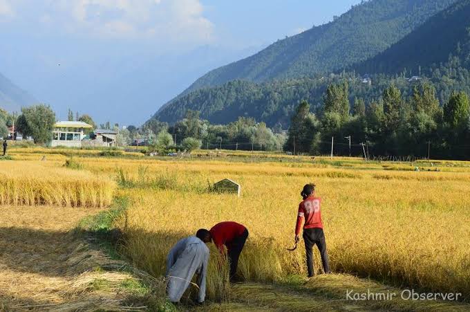

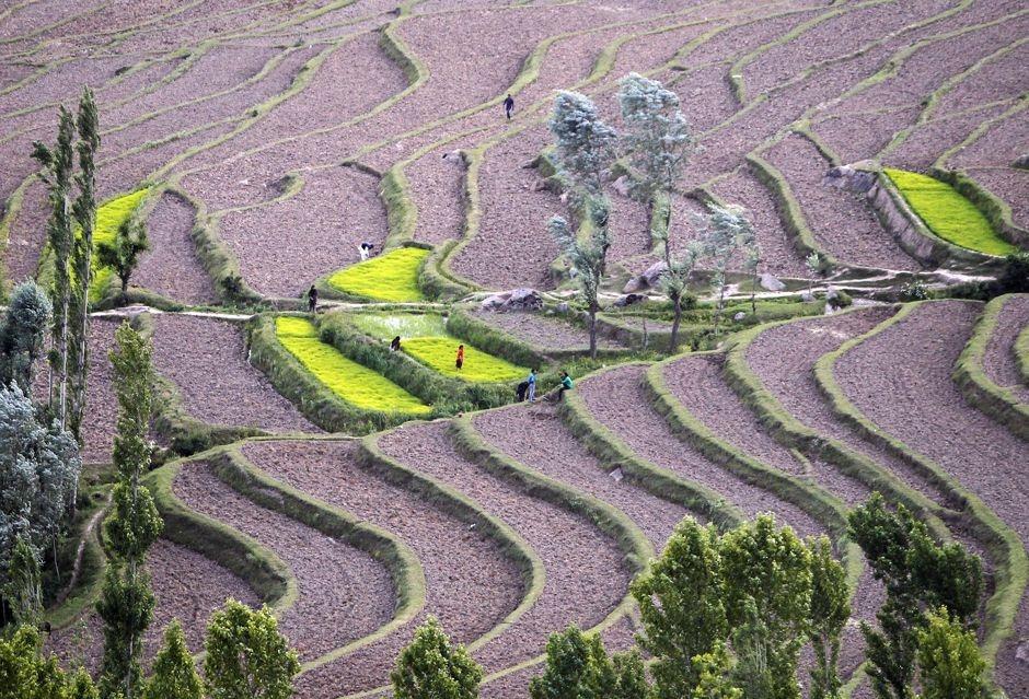
Across Kashmir, fields that once changed colour with the seasons are increasingly being edged out by the fixed geometry of urban life: housing colonies, commercial buildings and roads spreading into agricultural land.
The transformation is visible around expanding towns, where paddy fields sit beside new construction and the boundaries between villages and urban settlements become harder to distinguish. In a region where cultivable land is scarce, every field lost to permanent development raises a question that extends beyond the changing landscape: how much room will remain for agriculture?
Government statistics offer one measure of the pressure. Jammu and Kashmir’s paddy cultivation covered 1,32,641 hectares in 2024-25, according to the Union Territory government’s Regional Digest of Statistics 2024-25. That was a recovery from 1,29,021 hectares recorded in 2023-24, but it remained substantially below the 1,62,309 hectares reported in 2012-13 in an earlier statistical series.
The difference between the two figures is 29,668 hectares, equivalent to approximately 5.93 lakh kanal.
The comparison points to a long-term contraction in the area under paddy cultivation, although differences in statistical definitions and coverage need to be checked before the figures can be treated as a definitive measure of change. Nor does a decline in paddy acreage, on its own, establish how much land has been permanently lost to construction.
Still, the numbers highlight the pressures facing agriculture in a region where mountains, forests and other terrain leave only a limited share of the landscape suitable for cultivation.
The concern is not simply that fields are disappearing from the view. It is that fertile agricultural land, once covered by permanent structures, is difficult to restore to production.
The scarcity of cultivable land makes its conversion particularly consequential for Jammu and Kashmir.
An estimate frequently cited in discussions of the region’s agricultural constraints puts cultivable land at around 4.4 per cent of its geographical area. That figure requires verification against its original source and geographical coverage before it can be applied specifically to the present Union Territory.
Historical estimates for the erstwhile state of Jammu and Kashmir, including present-day Ladakh, placed cultivable land at approximately 10.75 lakh hectares against a geographical area of around 2.22 crore hectares, or 4.84 per cent.
The broader point remains: much of the region’s terrain is not suitable for conventional cultivation, making productive agricultural land a limited resource.
The Union Agriculture Ministry’s statistics put cultivable land in Jammu and Kashmir at 10.97 lakh hectares in 2024-25, compared with 10.74 lakh hectares in 2020-21. The latest figure is provisional.
These figures do not, by themselves, establish whether agricultural land is being permanently diverted to non-farm uses. Cultivable land is a broader category than the area actively sown, and land-use statistics can change for reasons other than construction.
A field may shift from paddy to an orchard or another crop and remain agricultural land. A plot covered by a residential complex, by contrast, may be permanently removed from cultivation.
Distinguishing between those changes is essential to understanding the scale of the problem.
The absence of an updated, publicly available account of agricultural land conversion makes it difficult to establish precisely how much productive land has been lost to buildings, roads and other development.
Without such an assessment, the long-term decline in paddy acreage provides an important warning sign but not a complete picture of the forces reshaping the agricultural landscape.
The pressure is particularly visible around urban centres, where expanding settlements bring residential and commercial development closer to cultivated fields.
Land that once formed part of the agricultural landscape is increasingly bordered by housing colonies, shops and other structures. As settlements spread, fields can become surrounded by built-up areas, changing the character of farming communities and the uses to which nearby land is put.
Similar land-use pressures have been reported in parts of the Jammu region.
A senior Agriculture Department official acknowledged that agricultural land conversion was taking place across Kashmir and described it as a concern for both the government and communities.
The pressures are not confined to a single district or type of settlement. Where construction expands into agricultural areas, the change can affect the availability of land for cultivation as well as the livelihoods connected to it.
The consequences can extend beyond the individual landowner. Agriculture supports labourers, transporters, traders and businesses involved in supplying inputs or handling produce. A reduction in productive acreage can affect parts of this wider economic network, although the scale of those effects depends on the location and type of land involved.
The conversion of agricultural fields also changes the relationship between settlements and the land that supplies food and income. Once construction becomes permanent, returning a plot to cultivation may be technically difficult, financially impractical or impossible.
That makes the loss different from a temporary fallow period or a change in crops.
The paddy figures provide a useful long-term comparison, but they need to be interpreted carefully.
The area under paddy cultivation fell from 1,62,309 hectares in 2012-13 to 1,29,021 hectares in 2023-24 before rising to 1,32,641 hectares in 2024-25.
The latest increase suggests that the contraction was not uninterrupted. It does not, however, erase the gap between the latest reported acreage and the earlier figure.
The difference of 29,668 hectares – about 5.93 lakh kanal – is substantial. But it measures the difference between reported areas under paddy cultivation, not the amount of land that has necessarily been built over.
Several processes can influence the area under a particular crop. Farmers may change crops in response to costs, returns, water availability or other considerations. Some land may be temporarily left uncultivated, while some may be used for orchards or other agricultural purposes.
Construction is a separate category of change. Establishing how much paddy land has been permanently converted to non-agricultural use requires land records that track the purpose for which plots are being used over time.
A reliable assessment would need to distinguish among these possibilities and reconcile agricultural statistics with land-use records and planning approvals.
That information would help policymakers identify where conversion is occurring, which categories of land are most affected and whether existing rules are adequately protecting agricultural areas.
It would also make it easier to measure the effectiveness of any safeguards introduced by the government.
Agriculture and allied activities remain important sources of employment and income in Jammu and Kashmir. The future of productive land therefore has implications for more than the size of the annual harvest.
For farming households, land provides a source of income and an asset that can support livelihoods across generations. For agricultural labourers, cultivated fields generate seasonal work. For businesses linked to farming, the volume and reliability of production influence demand for services, transport and supplies.
When agricultural land is permanently converted, those economic functions can be disrupted.
The effects vary. A farmer who changes from paddy to another crop may continue to earn from the same plot, while a household whose land is absorbed into urban development faces a different set of choices. Some landowners may benefit financially from selling land for construction, but that does not necessarily replace the broader economic activity associated with cultivation or provide the same livelihood for agricultural workers.
The implications for food production also deserve attention. A smaller area under cultivation can place pressure on local production, depending on yields, crop choices and demand.
Higher productivity and improved farming practices can partly offset reductions in cultivated acreage. Better seeds, irrigation, mechanisation and other improvements can help farmers produce more from the land they retain.
But higher yields cannot indefinitely compensate for the permanent removal of fertile fields from agriculture. Productivity gains also depend on investment, access to inputs and the suitability of local conditions.
A shrinking agricultural base therefore raises questions about the balance between urban expansion, farm incomes and the region’s capacity to supply its own food.
It may also affect dependence on supplies from outside J&K, although the extent of that dependence cannot be established from paddy acreage alone.
The challenge for policymakers is to balance the need for housing, infrastructure and economic development with the protection of land that is difficult to replace.
That requires more than identifying a decline in cultivated acreage. It requires an updated account of how agricultural land is being used, where conversion is occurring and how much of it involves permanent construction.
Agricultural records, land-use mapping and development approvals could provide a clearer picture if assessed together. Such information would help distinguish ordinary changes in cropping patterns from the loss of farmland to urbanisation.
It could also support more informed decisions about where new development should take place and which agricultural areas warrant greater protection.
The government would then be better placed to assess whether planning controls are working, identify gaps in enforcement and establish measurable targets for conserving productive land.
Any such approach would have to recognise the needs of growing settlements. Housing and infrastructure cannot be planned in isolation from population growth and economic activity. But development decisions also carry long-term consequences when they permanently alter scarce agricultural resources.
The absence of a clear, updated accounting of land conversion makes that trade-off harder to evaluate.
For now, the statistics offer two related but distinct signals. Paddy acreage remains below its reported level in 2012-13, while official estimates of cultivable land describe a broader resource whose precise conversion to non-farm uses is not fully established by the available figures.
Together, they point to the need for closer scrutiny of how Jammu and Kashmir’s land is changing.
The question is not whether the region should develop, but whether development can proceed without steadily eroding the agricultural base that supports livelihoods and food production.
A housing colony can replace a field in a matter of months. Rebuilding the soil, agricultural infrastructure and economic activity associated with that field is a much longer undertaking.
In a territory where cultivable land is limited, the decisions made at the expanding edges of towns may help determine how much room remains for farming in the decades ahead.