


The road connecting Jammu and Srinagar was never merely a highway.
For generations, Kashmir’s geography defined its destiny. Now, an unprecedented wave of tunnels, highways and high-speed corridors is attempting to rewrite the map – and perhaps the future – of Jammu and Kashmir. Daanish Mohiuddin reports.
For anyone who has travelled the old Jammu-Srinagar highway, time has always been measured differently. Not in hours. In uncertainty.
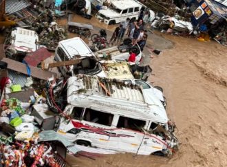
The journey begins with optimism. Vehicles snake through the plains of Jammu before entering the mountains. Then come the landslide zones. The traffic bottlenecks. The narrow stretches where trucks inch forward in long convoys. The unexpected closures caused by snowfall, shooting stones, road repairs or weather alerts.
A traveller leaving Jammu in the morning often carried a simple hope: that the highway would remain open long enough to reach Srinagar before nightfall.
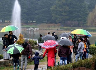
For generations, this uncertainty shaped life in Jammu and Kashmir. Students missed examinations. Patients struggled to access medical care. Businesses calculated losses around road closures. Fruit growers worried about delays reaching markets. Families planned weddings and funerals around weather forecasts.
The road connecting Jammu and Srinagar was never merely a highway. It was the region’s lifeline. And lifelines, when interrupted, reveal just how dependent a society is upon them. Today, however, engineers, planners and policymakers are attempting something extraordinary. They are trying to compress geography.
The Centre says four high-speed highway corridors worth nearly Rs 50,000 crore are currently under construction across Jammu and Kashmir, part of a broader infrastructure programme exceeding Rs 70,000 crore. Once completed, officials say, the journey between Jammu and Srinagar could be reduced from nearly nine hours to around four.
If achieved, the transformation would not simply change travel. It would change the meaning of distance itself.
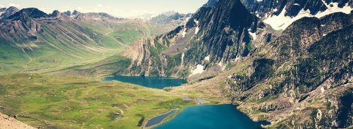
To understand the significance of what is underway, one must first understand the obstacle. The Himalayas are magnificent. They are also inconvenient. Mountains create beauty, but they complicate movement.
Roads cannot move in straight lines. Rivers carve deep valleys. Snowfall isolates communities. Landslides erase months of engineering work in a single afternoon.
For much of modern history, Kashmir’s economy, politics and daily life were constrained by these realities.
The Valley often felt closer emotionally to the rest of India than it did physically. A trip that appeared modest on a map could become an all-day ordeal.
Goods moved slowly. Tourists arrived cautiously. Investment remained limited.
Infrastructure projects frequently encountered delays and escalating costs.
Geography exercised a quiet but persistent authority over development. The mountains dictated terms. Humans negotiated. Usually, the mountains won.
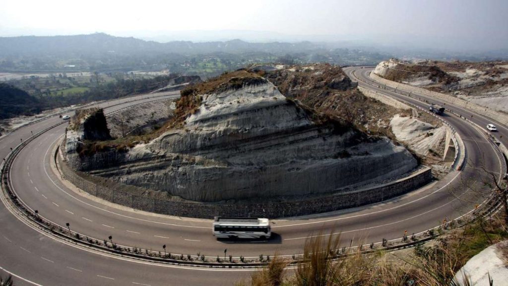
The story of Jammu and Kashmir’s infrastructure transformation is, in many ways, the story of tunnels. For decades, tunnels represented rare engineering achievements in the region. Before 2014, only a handful of major tunnels existed. Today, the landscape is changing dramatically. The Jammu-Srinagar national highway corridor alone now incorporates 25 tunnels, according to government officials. Twenty have been completed, while five remain under construction. This statistic reveals something larger than infrastructure investment. It reflects a philosophical shift.
Historically, roads adapted to mountains. Now engineers increasingly seek to move through them. The tunnel is perhaps humanity’s most direct response to geography. A mountain says go around. A tunnel says go through. Every kilometre excavated beneath rock represents an effort to challenge terrain that once dictated movement.
Among the most ambitious projects are the Zojila Tunnel, Sadhna Tunnel, Peer Ki Gali Tunnel, Bhimber Gali Tunnel, Sudhmahadev Tunnel and several new alignments designed to create all-weather connectivity. These projects are not merely transportation infrastructure. They are attempts to reduce the power of seasons.
In Kashmir, winter has long functioned as an unofficial transportation authority. Snowfall decides which roads remain open. Avalanches determine accessibility. Weather dictates schedules. Tunnels offer the possibility of something revolutionary in the Himalayas: predictability.
Infrastructure projects elsewhere are often measured in kilometres. In Jammu and Kashmir, they are measured in challenges. Every road must contend with geology. Every bridge must confront altitude. Every tunnel must navigate unpredictable rock formations.
The Jammu-Udhampur-Srinagar four-lane highway illustrates the scale of ambition.
Valued at approximately Rs 16,000 crore and reportedly nearing completion, the corridor incorporates tunnels, viaducts, bypasses and sophisticated slope-stabilisation measures.
Engineers have spent years attempting to solve a problem that generations accepted as unavoidable.
How do you build reliable connectivity through one of the world’s most complex mountain systems? The answer involves extraordinary engineering. Massive retaining walls. Advanced monitoring systems. Rock-bolting technologies. Slope stabilisation. Multi-level viaducts suspended across deep valleys. The resulting infrastructure often resembles something closer to a science-fiction landscape than a conventional highway. Drivers emerge from tunnels onto elevated bridges, disappear beneath mountains and reappear miles away. The journey increasingly feels less like mountain travel and more like movement through a carefully engineered corridor.
Among all the statistics associated with Jammu and Kashmir’s infrastructure programme, one stands out. Four hours. It has become the symbolic number around which the transformation revolves. For decades, the Jammu-Srinagar journey represented endurance. Now officials say it may eventually represent convenience. The significance extends far beyond tourism. Time, after all, is an economic resource. Reducing travel times changes behaviour. Businesses expand their operational horizons. Investors reassess opportunities. Supply chains become more efficient. Healthcare access improves. Educational institutions become more accessible. Entire regions feel closer.
Economists often describe infrastructure as a multiplier. Roads do not merely enable movement. They create possibilities. A four-hour journey alters calculations that individuals and businesses make every day. Distance becomes less intimidating. Opportunities become more reachable. Markets become larger. The psychological map of a region changes alongside its physical one.
Infrastructure debates frequently focus on engineering. Yet roads ultimately exist for people. And people move for reasons. Tourists travel to destinations. Pilgrims journey to shrines. Farmers transport produce. Businesses ship goods. Families visit relatives. Students pursue education.
Each journey contributes to economic activity. Jammu and Kashmir’s infrastructure programme is designed around this reality. Officials say improved connectivity will support tourism, trade, industry and pilgrimage traffic while strengthening access to border areas and remote districts. The impact could be particularly significant for sectors dependent upon speed.
Consider horticulture. Kashmir’s apples, cherries and other fruit products are highly sensitive to transportation delays. Hours matter. Road closures matter. Predictability matters. Every improvement in connectivity potentially translates into reduced losses and better market access.
The same logic applies to tourism. A destination that is easier to reach is often more likely to attract visitors. Convenience influences choices. Infrastructure influences convenience. The relationship is straightforward.
Not all transformation is occurring between cities. Some of it is happening around them. The Srinagar Ring Road, estimated at approximately Rs 7,200 crore, reflects a growing recognition that urban mobility matters as much as regional connectivity. Cities evolve. Traffic grows. Road networks designed for earlier populations struggle to accommodate modern volumes. Ring roads represent an attempt to redirect movement. Rather than forcing through-traffic into urban centres, they create alternative pathways around them. For Srinagar, this could significantly alter transportation dynamics. The project aims to improve connectivity with north Kashmir, central Kashmir and routes extending toward Ladakh. The city itself may become easier to navigate.
The same logic underpins developments in Jammu, where ring-road infrastructure continues to expand. Together, these projects suggest that planners are increasingly thinking not only about highways but about integrated mobility systems.
There is another aspect to these projects that receives less public attention but remains strategically significant. Location. Jammu and Kashmir occupies one of India’s most sensitive geographic positions. Connectivity in border regions serves multiple purposes. Economic. Social. Administrative. Strategic.
Roads that improve civilian mobility often enhance logistical capabilities as well. This dual function helps explain why connectivity projects extending toward Kupwara, Tangdhar, Rajouri, Poonch and other frontier regions receive sustained attention. Infrastructure in such areas is rarely just infrastructure. It becomes part of a broader vision of integration and accessibility. For residents of remote communities, however, the implications are often simpler. A better road means easier access to schools, hospitals, markets and government services. Sometimes geopolitics begins with something as basic as reaching town more quickly.
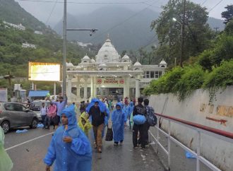
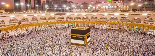
Religious travel has long shaped transportation patterns in Jammu and Kashmir. Millions visit the Shri Mata Vaishno Devi shrine annually. Thousands undertake the Amarnath Yatra. Pilgrimage routes generate enormous economic activity.
The Delhi-Amritsar-Katra Greenfield Expressway, valued at approximately Rs 41,000 crore, reflects the growing importance of this sector. Officials say the project will reduce the distance between Delhi and Katra while improving access for pilgrims.
Meanwhile, additional road projects linked to the Amarnath Yatra are under preparation. Together, these initiatives suggest a broader effort to reimagine how religious tourism functions within northern India. Connectivity becomes not merely a convenience but an economic catalyst.
Perhaps the most intriguing aspect of the infrastructure vision lies above the roads. The government has received dozens of ropeway proposals worth roughly Rs 30,000 crore, with several projects identified for implementation. The locations themselves reveal the ambition.
Amarnath. Shankaracharya. Doodhpathri. Thajiwas Glacier. Bhadarwah. Sanasar. These are places where terrain often limits accessibility. Ropeways offer an alternative model of movement. Instead of carving roads through landscapes, they float above them. The technology promises faster access, reduced travel times and potentially lower environmental disruption compared to traditional road expansion. If highways are rewriting horizontal geography, ropeways may begin rewriting vertical geography.
No discussion of infrastructure in the Himalayas is complete without acknowledging environmental concerns. Large-scale construction inevitably alters landscapes. Mountains are excavated. Slopes are modified. Vegetation is removed. River systems can be affected.
Supporters argue that modern engineering techniques minimise environmental impact while delivering substantial economic benefits. Critics caution that fragile Himalayan ecosystems require exceptional care. Both perspectives contain validity.
The challenge facing policymakers is balancing development with sustainability. The stakes are unusually high because the Himalayas are not ordinary terrain. They are among the world’s youngest and most dynamic mountain systems. Building here requires constant negotiation with nature. Success depends not only on speed but also on restraint.
The most profound consequence of Jammu and Kashmir’s infrastructure transformation may not be physical. It may be psychological. Regions often understand themselves through distance.
How far away is opportunity? How difficult is travel? How accessible are markets? How connected are communities?
Infrastructure changes the answers. When roads improve, perceptions change. Places that once felt remote begin to feel connected. Journeys that required planning become routine. Economic possibilities expand. Social interactions increase. The mental map evolves. This may ultimately be the greatest significance of the four-hour promise.
It is not simply about reducing travel time. It is about redefining what is considered near and what is considered far.
Much remains unfinished. Tunnels are still being excavated. Corridors are still under construction. Bottlenecks remain. Deadlines will be tested. Engineering challenges will persist. The Himalayas are not easily conquered. Yet something unmistakable is occurring.
A region long defined by difficult connectivity is attempting to reinvent itself through infrastructure on a historic scale.
For centuries, Kashmir’s mountains shaped movement, commerce and imagination. They connected some places and separated others. They protected and isolated. They inspired and constrained. Now, tunnels are being drilled through them. Highways are crossing them. Bridges are spanning them. The landscape is not disappearing. But its relationship with distance is changing.
And perhaps that is the real story. Not that Kashmir is becoming smaller. But that the barriers between its people, markets, destinations and opportunities are becoming less formidable. For generations, travellers measured the Jammu-Srinagar road by uncertainty.
Soon, they may measure it by time. Four hours. A simple number. A remarkable transformation.
About the Author
Danish Mohuiddin, a postgraduate in Convergent Journalism, approaches storytelling as a visual and narrative craft. With a strong interest in cinematography and filmmaking, his work often lingers on the human dimensions of news. Drawn to stories that matter to people, he writes with an eye for both movement and meaning.