
The mountains of Jammu and Kashmir rarely collapse without warning. Cracks widen, slopes bulge, drainage patterns change, and old scars become active again. The real failure, therefore, is not always geological. Sometimes it is institutional: failing to act on warnings already available.
Recent studies have provided the government with something invaluable – a map of where landslides are most likely to occur and evidence of the factors that make slopes unstable. Nearly 28 percent of the area assessed in one study falls in high or very high landslide-susceptibility zones, while about 87 percent of recorded landslides occurred within those categories.
This evidence should now move from research papers into government files, engineering drawings and field action.
The first requirement is a unified landslide-risk map for Jammu and Kashmir, regularly updated using satellite imagery, geological surveys, rainfall data and field observations. Such mapping should become a mandatory reference for road construction, widening, town planning, hydropower projects and other infrastructure in vulnerable terrain.
Second, the government must establish permanent monitoring of critical slopes, particularly along strategic highways and densely inhabited mountain corridors. Where satellite imagery detects movement, field teams should verify it. Where field teams identify cracks or ground deformation, the information should feed into a central early-warning system.
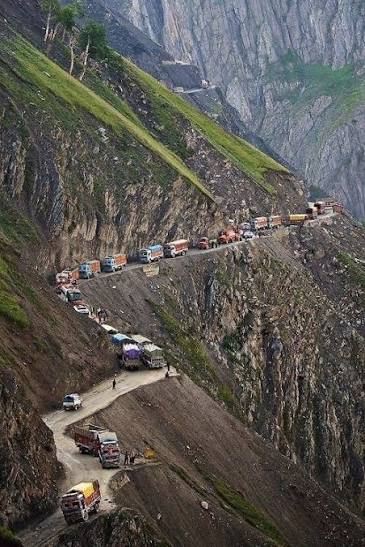
Third, road development needs to become geology-sensitive. The finding that road proximity is strongly associated with landslide occurrence should not be interpreted as an argument against roads. Connectivity is essential. But road cutting, drainage alteration, excavation and slope loading must be preceded by rigorous geological and environmental assessments. The safest engineering option—not merely the quickest or cheapest—should determine how a vulnerable stretch is developed.
Fourth, the government should create clear protocols for unstable slopes. A warning should trigger defined action: inspection, traffic restrictions where necessary, evacuation alerts, temporary shelters and emergency response. Communities living below vulnerable slopes should know what signs to watch for and whom to contact.
Fifth, drainage deserves far greater attention. Rainfall often acts as the trigger after instability has accumulated for years. Blocked drains, poorly directed runoff, and uncontrolled water seepage can turn a vulnerable slope into a disaster zone. Drainage systems along mountain roads and settlements should therefore be inspected and maintained before and during the monsoon and other periods of intense rainfall.
Sixth, development permissions in high-risk zones must be subject to stronger scrutiny. Expansion of settlements, roadside construction and slope cutting should not proceed simply because land is available. Hazard maps must become part of the planning process, with restrictions where scientific assessments indicate unacceptable risk.
The government should also create a single institutional mechanism for landslide risk, bringing together geology, disaster management, roads, forests, urban planning, remote sensing and district administration. At present, information can remain fragmented across departments and institutions. A warning is useful only when it reaches the authority capable of acting on it.
Finally, every major highway corridor should have a risk register identifying unstable slopes, past failures, drainage vulnerabilities, evacuation routes and emergency contacts. These registers should be publicly accessible where security considerations permit.
J&K cannot prevent every landslide. It cannot stop rain, earthquakes or the geological processes that shape the Himalayas. But it can reduce exposure, strengthen infrastructure and act before a warning becomes a casualty list.
The research has already done much of the hardest work: identifying patterns and vulnerable terrain.
Now the government must do the equally important part – turn knowledge into prevention.
A mountain may take years to become unstable. The state should not take years to respond to the warning.