


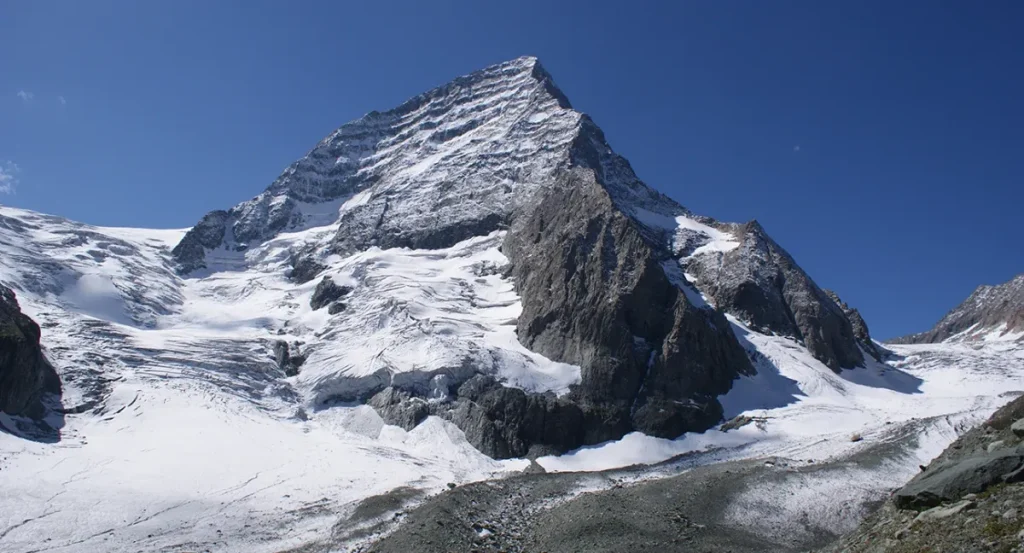
As Himalayan glaciers retreat and glacial lakes expand, scientists race to map the floods that could follow. Wajahat Iqbal Kashtwari reports.
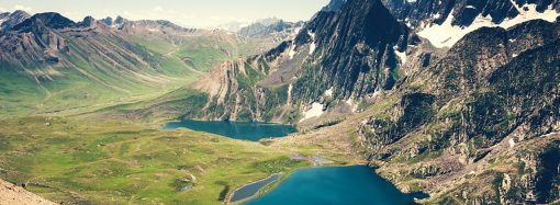
High in the Himalaya, where the mountains seem to have withdrawn from the ordinary business of the world, water is gathering.
It gathers in hollows left behind by retreating ice. It gathers beneath cliffs and along the edges of glaciers, in lakes whose surfaces may look still from a distance but whose existence is tied to a precarious geometry of ice, rock, snow and mud. Some of these lakes have formed slowly, over decades. Others have grown with unsettling speed. And behind their natural dams – ridges of loose moraine deposited by glaciers – there is a question that scientists are increasingly compelled to ask: What happens if the wall gives way?
The University of Kashmir and the Indian Institute of Technology Roorkee are now working together to find some answers.
The two institutions are part of a project aimed at identifying present and future risks from glacial lake outburst floods, or GLOFs, across the Indian Himalaya—a landscape where the effects of a changing climate are being written not only in shrinking glaciers but in the expanding waters that occupy the spaces they leave behind.
The project, funded under the Hydrology and Cryosphere programme of the Ministry of Earth Sciences, is an attempt to turn the Himalaya into a vast field of observation: its glaciers, its lakes, its valleys and the communities that live downstream. Through Earth observation data and modelling, researchers hope to develop methods that can investigate glacial lakes and determine which ones pose the greatest hazards. It is, in some sense, a race against uncertainty.
The Ministry of Earth Sciences sanctioned the project in 2022 at a total cost of Rs 91.2 million. Over the past three years, Rs 62.03 million has been released, Minister of State for Earth Sciences Jitendra Singh said in a written reply in the Lok Sabha on Wednesday.
The numbers are administrative, but the problem they describe is elemental.
A glacier melts. Water collects. A lake grows.
And somewhere below, perhaps many kilometres away, a village sits in a valley. A road winds along a river. A bridge carries traffic across a gorge. A hydropower project draws water from a mountain stream. People farm terraces that have existed for generations. The landscape appears permanent because mountains have always seemed permanent.
But the water remembers that nothing is.
A glacial lake outburst flood is a sudden release of water held behind a glacier or a natural moraine dam. The event can transform a remote mountain lake into the source of a destructive torrent, sending enormous quantities of water, rock and debris down valleys with little time for those in its path to respond.
The trigger may come from above or from within the mountain itself.
Heavy precipitation can push a fragile system beyond its limits. A cloudburst can deliver an extraordinary volume of water in a short period. An upstream lake may burst and send a cascading flood into another lake. A landslide can fall into the water, displacing it violently. An earthquake can disturb the foundations of a natural dam. Geological activity can alter a landscape that appears, to the human eye, unchanged.
The most obvious danger, however, may be the moraine itself.
Unlike engineered dams, moraine dams are not designed. They are piles of sediment, stones and glacial debris assembled by the slow and powerful movements of ice. Their apparent solidity can be deceptive. Their internal structure may be weak, their slopes unstable, their resistance difficult to predict.
When such a dam fails, the release can be abrupt. The water does not negotiate with the valley below.
For the Himalaya, the question is particularly urgent because the mountains contain thousands of glacial lakes scattered across a vast and difficult terrain. Many lie in places that are difficult to reach, making traditional field surveys expensive, dangerous and, in some cases, impractical.
This is where satellites become essential.
From above, the Himalaya can be studied as a changing map. Earth observation data can reveal the expansion or contraction of lakes, shifts in glacier boundaries and changes in the terrain surrounding them. When combined with modelling, such information may allow researchers to move beyond simply documenting what has happened to asking what might happen next.
The University of Kashmir-IIT Roorkee project is expected to examine glacial lakes across different climatic, geomorphological and topographic zones. The intention is not to treat the Himalaya as one uniform mountain system, but as a collection of distinct environments in which the same lake can behave differently depending on its setting.
A lake surrounded by steep unstable slopes presents one set of questions. Another, lying beneath a glacier or near a potentially active landslide zone, presents another. The vulnerability of a downstream settlement may depend not only on the lake itself but on the shape of the valley, the distance to inhabited areas and the infrastructure occupying the flood’s possible path.
Risk, in other words, is not simply a property of the lake. It is a relationship between water and everything below it.
The study will assess these risks across different time scales, an approach that introduces another layer of complexity. A lake that appears relatively stable today may not remain so. Glaciers change. Climate patterns shift. Snowfall and precipitation regimes evolve. The terrain around a lake may become unstable.
The Himalaya is not a static backdrop. It is a system in motion.
For scientists, this creates a problem of prediction. The most dangerous lake may not necessarily be the largest. The most immediate threat may not always come from the lake that looks most dramatic in a satellite image. A smaller body of water in the wrong place, behind an unstable moraine dam, may present a greater danger to a densely populated valley than a much larger lake in an isolated region. Understanding that difference is at the heart of hazard assessment.
The project’s expected findings could therefore help improve knowledge of how glacial lakes form, how they evolve and how their associated risks might be predicted. In the long term, that knowledge could prove valuable to communities living downstream, as well as to the infrastructure that connects the Himalayan region to the rest of the country.
For those communities, the science of glacial lakes is not an abstraction. It is a question of warning.
A flood that arrives without notice is one kind of disaster. A flood whose possibility has been mapped, modelled and communicated is another. The difference between the two may be measured in minutes, hours or days – but also in lives.
Remote mountain communities often have little warning when a GLOF begins. By the time a wall of water has entered a valley, there may be no opportunity to evacuate people, move livestock or protect essential infrastructure. The geography that makes the Himalaya beautiful – the narrow valleys, steep slopes and confined river corridors – can also amplify the consequences of a sudden flood.
A torrent released high in the mountains can gather force as it descends.
It can carry boulders. It can tear through roads. It can destroy bridges. It can bury settlements.
And then, almost as quickly as it began, the event can pass, leaving behind a valley altered beyond recognition.
The challenge is that the warning signs may be visible only from a distance.
This is why the partnership between a university in Kashmir and an institute with expertise in technology and engineering carries particular significance. The project sits at the intersection of several disciplines: hydrology, cryosphere science, remote sensing, geomorphology and climate research. It is an effort to understand the mountains not as isolated glaciers or lakes but as interconnected systems.
The work also reflects a broader shift in the way Himalayan hazards are studied.
For decades, scientists have documented glaciers, measured snow and monitored rivers. Increasingly, however, attention is turning toward the consequences of a rapidly changing cryosphere – the frozen part of the planet that includes glaciers, ice and snow.
When ice disappears, it does not simply vanish. It changes the landscape it leaves behind.
Glacial lakes can grow in newly exposed depressions. Water can accumulate where ice once provided structure. Slopes can become unstable. New connections can form between lakes and rivers. The consequences may unfold slowly, until an abrupt event compresses years of change into a few terrifying hours.
The project undertaken by the University of Kashmir and IIT Roorkee seeks to understand that chain of possibilities before it becomes a disaster.
Its ambition is substantial: to investigate glacial lakes across the Indian Himalaya, to understand their formation and development, and to assess the risks they may pose now and in the future.
The financial figures attached to the project – Rs 91.2 million sanctioned and Rs 62.03 million released – represent the machinery of public science. But the ultimate measure of the work will not be the amount spent or the number of satellite images analysed.
It will be whether knowledge travels from laboratories and computer models to the valleys below.
Whether a warning reaches a village in time. Whether a bridge can be reinforced before the flood. Whether an evacuation plan exists before the sirens sound. Whether a family living beside a Himalayan river can know that something has changed far above them.
The mountains have always generated their own weather, their own rivers and their own disasters. But the growing presence of glacial lakes introduces a new kind of uncertainty – one that is difficult to see from the valley floor and impossible to ignore from space.
The lake may look peaceful. The glacier may appear distant. The moraine dam may have held for centuries.
Yet every mountain lake carries a history of movement, and every natural barrier carries the possibility of failure.
The work now beginning is, at its core, an attempt to read those possibilities. To look at the Himalaya not merely as a landscape but as a warning system. To understand that the danger may begin where human eyes rarely reach. And to recognise, before the water comes rushing down, that the future of a mountain lake is inseparable from the future of everyone who lives beneath it.
About the Author
Wajahat Iqbal Kashtwari is a filmmaker and multimedia professional with a keen interest in environment, ecology, and climate change.